Photo: Charles Boyer / Talk of Titusville
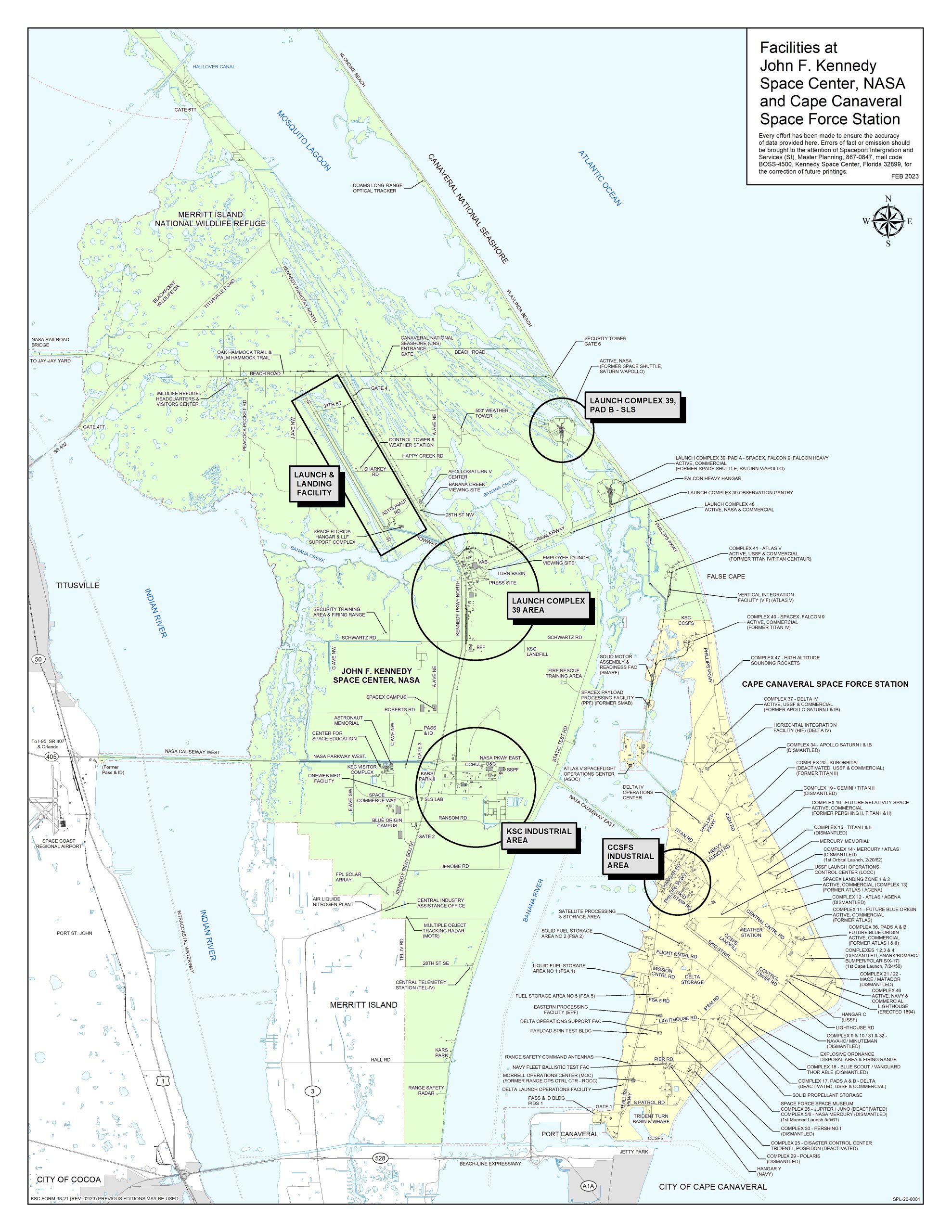
A lightning strike from a severe thunderstorm started a conflagration in Merritt Island Wildlife Refuge this afternoon. It is north of Kennedy Space Center, and is currently no threat to property or human endeavor — in other words, the facilities at Kennedy Space Center.
1PM EDT Update: Beach Road to Cape Canaveral National Seashore and Playalinda Beach has reopened to traffic. Only lingering wildfire smoke is in the area of the road, and any smoldering fire remaining active appears to be located well south of the road.
Previous Updates
Merritt Island National Wildlife Released this statement on social media at 10:25 AM Sunday: “Update on the current wildfire in the Peacocks Pocket marsh. Fire crews will be flying over the area this morning to better assess the size and scope of the fire. A plan of action will be formed after this flight and will depend greatly on the expected weather conditions. This area last burned a little over 3 years ago which is the natural cycle for refuge.”
MINWR official statement at around 11PM EDT May 25: “A lightning caused fire is currently burning in the Peacocks Pocket impoundment. The fire is estimated to be 150-200 acres. Fish & Wildlife firefighters are onsite and will monitor the blaze throughout the night. Expect all access roads to Peacocks Pocket to be closed tomorrow until fire crews determine they are safe, including: West Gator Creek, Gator Creek East Gator Creek, and Catfish Creek roads.”
11PM MAY 25: KSC Police are currently turning unbadged cars away Gate 4TT, at the end of Max Brewer Bridge. They have also cleared the Refuge of spectators. (see above: the road has reopened to traffic headed towards CCNS/Playlinda Beach and Gate 4 for KSC)


Graphic: original map is from the 2021 KSC Facilities Map, NASA
12 PM EDT, Sunday: Beach Road Open, Fire Seems To Be Dwindling
From a distance and to the uneducated naked eye, the wildfire is now starting to burn itself out, especially on its northern edges. Still far away from operational KSC facilities and buildings, no flames could be seen from Beach Road or US-1 in Titusville, which is very different than twelve hours earlier.
That does not mean that the fire is no longer any danger — a change in weather conditions or wind direction and speeds could fan the flames. Stay tuned to local authorities for official status updates. We will pass them along as soon as we receive them.


Photo: Charles Boyer / Talk of Titusville


Photo: Charles Boyer / ToT
11 PM EDT, Saturday: KSC Closes Beach Road
Around 11 PM EDT, KSC Police were emptying MINWR and were stopping people at the end of Max Brewer Bridge. KSC Police asked me to leave, and that’s exactly what I immediately did: I skedaddled.


Photo: Charles Boyer / Talk of Titusville


Photo: Charles Boyer / Talk of Titusville


Photo: Charles Boyer / ToT


7 PM EDT, Saturday: Fire Is Spreading


Photo: Charles Boyer / Talk of Titusville